Tide Control / Height Control / Water Level
Tide and Height Control provides settings and choices on how VOSS RT calculates the height of your equipment and/or the water level.
In VOSS RT your equipment is either floating or non-floating:
At the top right of the screen, this button on the Caption Bar  shows the current level of the water.
Floating Equipment
Your equipment is floating for VOSS RT. This decision was made by the
Surveyor in the Equipment Editor Part of the VOSS.net software package, in which all parameters, dimensions, layout, arms, heads and interfacing with other equipment can be defined, normally by the surveyor. outside of VOSS RT.
In case of floating equipment you will have three choices for Height Control:
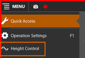
 MENU > Height Control:
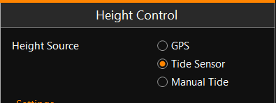
Height Source: GPS
The height of the body of your equipment will be calculated from the
height of your GPS Global Positioning System is a space-based satellite navigation system that provides location and time information in all weather, anywhere on or near the Earth, where there is an unobstructed line of sight to four or more GPS satellites. It is maintained by the United States government and is freely accessible to anyone with a GPS reciever. antenna (combined with attitude sensors, if
installed).
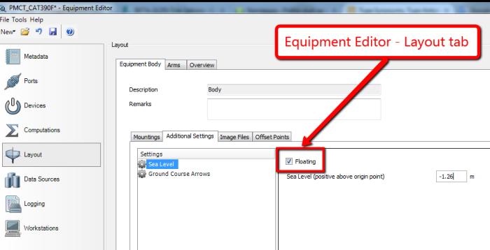
To be able to find out the water level, either your equipment has one or more draft sensors, or a fixed draft was set by the surveyor outside of VOSS RT in the Equipment Editor.
Equipment Editor > Layout > Equipment Body > Additional Settings
> Sea Level:
You need to have an RTK GPS receiver and antenna on board to have a reliable and stable height calculation.
Height Source: Tide Sensor
The height of the water level is the basis to find out the height of the body of your floating equipment, combined with one or more draft sensors or a fixed draft value set by the surveyor outside of VOSS RT in the Equipment Editor.
Equipment Editor > Layout > Equipment Body > Additional Settings
> Sea Level:
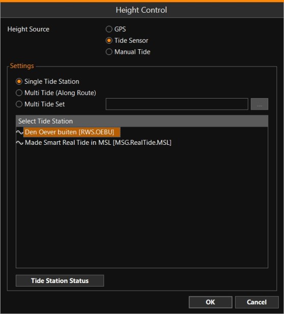
The Tide Sensor can be a Single Tide Station, Multi Tide along a route or a Multi Tide Set..
Tide gauges and Predicted Tide files will appear in the same list:
See: Single Tide and Multi Tide
Height Source: Manual Tide
The height of the water level is the basis to find out the height of the body of your floating equipment, combined with one or more draft sensors or a fixed draft value set by the surveyor outside VOSS RT in the Equipment Editor.
Instead of using a predicted tide file or a tide gauge, the tidal height can be entered by the user manually, for example tide obtained from Port Control by VHF.
Non-Floating Equipment
If your equipment is not floating, then RTK GPS will be the height source to calculate the height of the body of your equipment.
This will for sure be the case if your equipment is a land based excavator, for example.
For coastal work it can be handy to also present the water level in VOSS RT.
A wrong water level will not affect the height of the body, arm(s) and head(s), as the basis is the RTK GPS height.
You can then choose between:
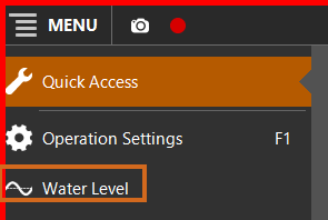
MENU > Water Level:
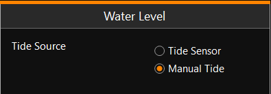
Water Level: Tide Sensor
The water level will be presented based on one or more tide sensors. See: Single Tide and Multi Tide
Water Level: Manual Tide
Instead of using a predicted tide file or a tide gauge, the tidal height can be put in by the user manually, for example tide obtained from Port Control by VHF.
See also: Water Level