User Waypoint
The user can define Waypoints Set of coordinates that identify a point in physical space. Waypoints for navigational use are usually defined in two dimensions (e.g. latitude, longitude, or Easting, Northing) in the Drawing Mode.
On this page:
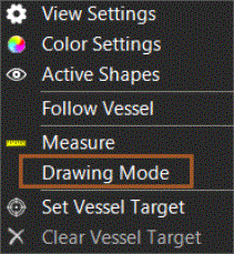
Start Drawing Mode
 Right mouse click in
Top View > Drawing Mode
Right mouse click in
Top View > Drawing Mode
Insert Waypoint
Click on the Waypoint Icon:

You can either place the Waypoint graphically by moving the mouse to the desired location and clicking, or you can type in the co-ordinates.
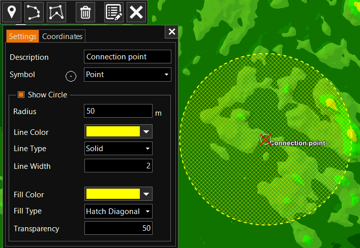
Description - Give a name to the Waypoint.
Symbol - Choose a Symbol for ease of recognition in the Top View.
Show Circle - Optionally define a Circle around the Waypoint.
Edit User Waypoint
To Edit a User Waypoint, first Start Drawing Mode.
Select a Waypoint:
-
graphically: look up the Waypoint in the Top View and double click on it. Another click will let you move it graphically.
-
from a list, click on
 and select the Waypoint
to edit.
and select the Waypoint
to edit.
Delete User Waypoint
See: Delete User Waypoint, Polyline or Polygon