AIS
AIS Automatic Identification System - is comprised of small transponders fitted to shipping vessels worldwide, which use short wave VHF radio signals to broadcast each vessel’s position, unique International Maritime Organisation (IMO) identity number and other useful information. The transmissions can be received by any vessel, land station or satellite in range and fitted with an AIS receiver. means Automatic Identification System. VOSS RT is capable of displaying
other vessels in your vicinity by means of AIS.
Automatic Identification System - is comprised of small transponders fitted to shipping vessels worldwide, which use short wave VHF radio signals to broadcast each vessel’s position, unique International Maritime Organisation (IMO) identity number and other useful information. The transmissions can be received by any vessel, land station or satellite in range and fitted with an AIS receiver. means Automatic Identification System. VOSS RT is capable of displaying
other vessels in your vicinity by means of AIS.
On this page:
 Tip for crew tenders: you can use a vessel
position received by AIS as a target to sail to, see: Navigate
to (homing line)
Tip for crew tenders: you can use a vessel
position received by AIS as a target to sail to, see: Navigate
to (homing line)
Show AIS Data
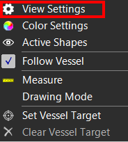
To show other vessels on your Top View, based on AIS:
 Right mouse click in Top View > View Settings > Show AIS Data
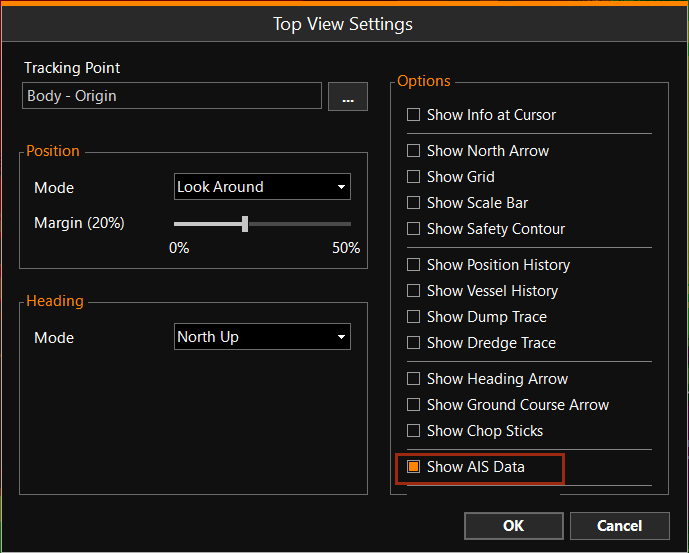
The names of the other vessels will be shown.
When you hover your mouse pointer over a vessel, a complete information box will be shown.
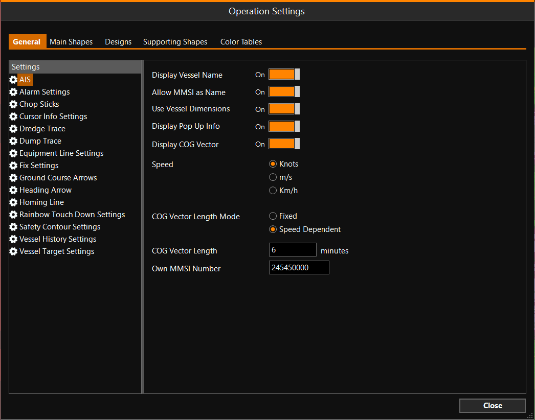
AIS Settings
Indicate how you would like to show the AIS Data in your screen:
MENU > Operation
Settings > General > AIS or:
Keyboard: F1 >
General > AIS
|
AIS |
|
|---|---|
|
Display Vessel Name |
Turn On to see the vessel names in the Top View. |
|
Only when no Vessel name is available, will this show. |
|
|
Use Vessel Dimensions |
Will draw the vessel using its own dimensions. When Off, the regular triangle is shown. (The same as when you are zoomed out.) |
|
Display Pop Up Info |
When you hover your mouse pointer over an AIS target, it will show an information box with all available AIS info. |
|
Display COG Vector |
When the AIS target has a speed, a Course Over Ground vector will be shown in front of it. |
|
Speed |
Select how to display the speed in the information pop up box. |
|
COG Vector Length Mode |
Available when 'Display COG Vector' was activated:
|
|
COG Vector Length |
Available when 'Display COG Vector' was activated. Enter how many minutes long the Course Over Ground vector should be. |
|
Own MMSI Number |
The MMSI number of your own vessel, which appears on other vessels' screens. This cannot be adjusted. |
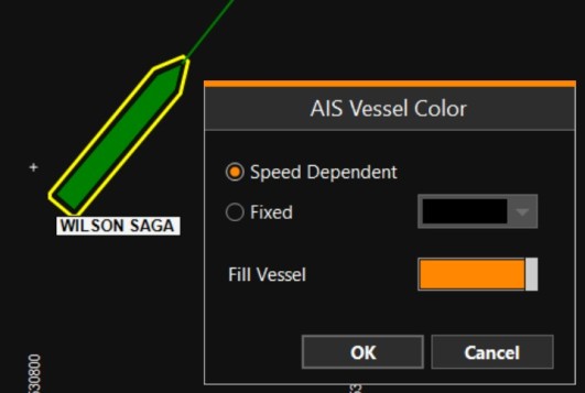
AIS Vessel Color
By default, the colors of AIS vessels depend on their speed.
The color of individual vessels can be changed to a fixed color by clicking on them in the Top View and using option Edit Vessel:
AIS Alarms
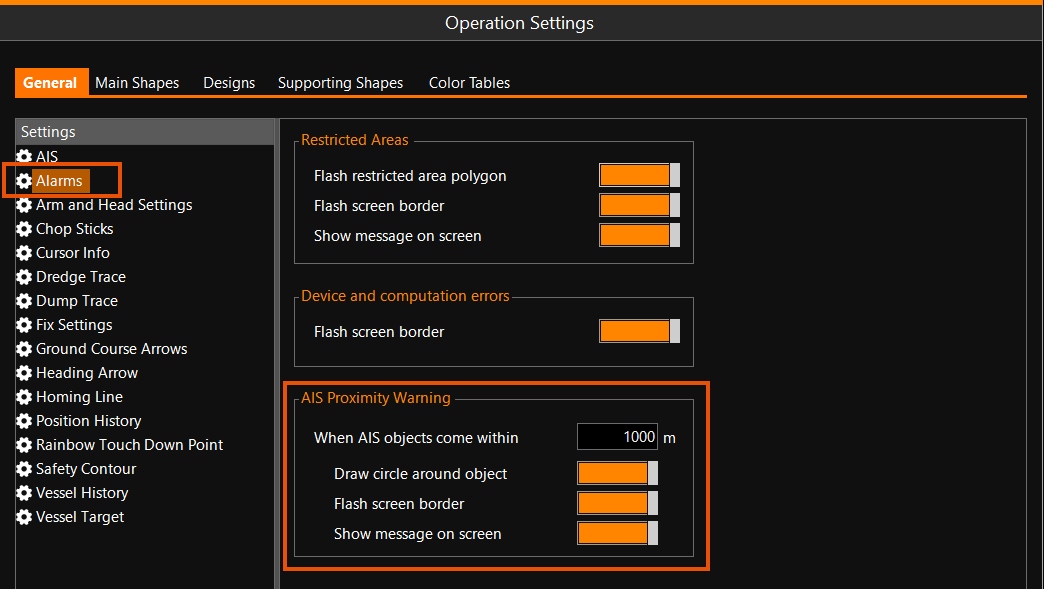
When another vessel received via AIS comes closer than a distance, set by the user, three types of alarms can be generated:
-
A circle is drawn around the vessel that comes within the Proximity distance
-
The border of the VOSS RT can be set to start flashing
-
A warning message can be shown on screen that one (or more) vessels are within the Proximity distance
The various AIS Proximity warnings can be set here:
MENU > Operation
Settings > General > Alarms: