Active Shapes
This window lists the shapes A geometric entity or a collection of such entities. Each entity is described by basic geometry such as a point, a line or an arc. Examples of shapes are: Route, Centerline, Waypoints, Fix Set, Dump Boxes, Progress Grid Model, Designs, etc. which can be (de-)activated.
Remember that this changes nothing in the Operation Settings, it only turns visibility on or off.
 Right mouse click in
Top View > Active Shapes
Right mouse click in
Top View > Active Shapes
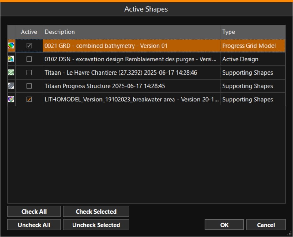
If a Voxel In 3D computer graphics, a voxel represents a value on a regular grid in three-dimensional space.
Voxels are a surface that can be used to integrate survey and geotechnical data in a single feature.
In VOSS RT they are used for construction and dredging vessels, so the crew can see the types of soil present in various layers. layer (containing Lithology data from Boreholes This is defined by the observed downhole soil descriptions (which may repeat) and their layer thickness (lithology).) is available in your project, make sure it is activated to be able to see it in your Back View / Left View / Right View.
The Voxel is only shown when there is Progress Grid A type of DTM that is made manageable through sampling measured points into a regularly spaced raster, allowing fast and conditional access. Considered to be a secondary data set; since no original points are kept.. data present at that point in order to prevent you from using the Voxel as the depth.